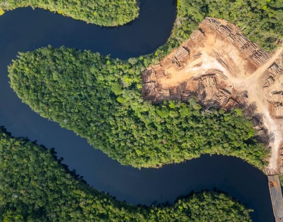
A map tracking the distribution of chemical isotopes in tree
wood acoss the Amazon could become a powerful new weapon against
illegal logging.
The illegal timber trade remains one of the primary drivers of
deforestation across the region.
By analyzing the ratios of different isotopes in elements like
oxygen, carbon, nitrogen, and strontium, researchers can
identify where a piece of timber came from with much greater
precision.
This gives investigators a far more accurate way to trace the
wood’s geographic origin.
The tool is being developed by a research group led by Luiz
Antonio Martinelli, a professor at the Center for Nuclear Energy
in Agriculture at the University of São Paulo.
It’s designed to address a persistent gap in how Brazilian
authorities currently verify timber origin.
Illegal logging slips through
Environmental agencies and law enforcement in Brazil already
rely on a range of tools to trace where timber comes from.
These tools include analyzing plant anatomy, cross-referencing
species distribution, and consulting official paperwork like the
Forest Origin Document.
However, these methods aren’t always sufficient to reliably
confirm that a shipment of timber was actually harvested
legally, leaving real gaps that illegal loggers can exploit.
Martinelli’s team is working to close that gap using isotopes,
forms of a chemical element that share the same atomic number
but differ in mass.
The approach involves building a detailed map of how these
isotopic signatures naturally vary in wood from different parts
of the Amazon.
Police could then compare seized wood samples against that
reference map to help determine where the timber originated.
Isotopes are nearly impossible to fake
“Our goal is to provide the Federal Police with a tamper-proof
method. You can’t falsify stable isotopes,” Martinelli said.
That tamper-resistance is central to the tool’s appeal, since it
removes the possibility of loggers fooling the system by forging
documents or otherwise manipulating more conventional tracking
methods.
Once the isotope distribution map, known as an isoscape, is
finalized, experts outside specialized research laboratories
should be able to apply the methodology fairly easily.
A clear pattern written in wood
The core methodology involves calculating the ratio between two
different isotopes of the same element, such as oxygen-18 and
oxygen-16, found within the cellulose that makes up wood.
The analysis revealed a clear geographic gradient running from
southwest to northwest across the Amazon. The lighter oxygen
isotope was most abundant in the western part of the Amazon
forest.
Wood from the western Amazon contains proportionally more
oxygen-16 and less oxygen-18 compared to wood harvested from the
eastern part of the forest.
That pattern traces back to basic atmospheric physics. As
moisture originating from the Atlantic Ocean moves inland across
the continent, it gradually loses the heavier form of oxygen
along the way.
By the time that moisture reaches the western Amazon, it has
already shed some of its oxygen-18.
As a result, plants in that region incorporate smaller amounts
of the heavier isotope into their wood as they grow.
One isotope isn’t enough
Oxygen alone can’t carry the full weight of this identification
task, though.
“Since the Amazon is so complex – a very large area – it isn’t
possible to use just one isotope,” Martinelli explained.
To build a more complete picture, an ongoing doctoral project
led by PhD student Isabela Maria Souza Silva is currently
mapping the isotopic signatures of two additional elements,
carbon and nitrogen.
The team also plans to eventually incorporate strontium into the
model, adding yet another layer of geographic specificity.
Amazon helps Improve the isotope model
As it stands today, the tool still has real limitations worth
acknowledging.
“Our best model can exclude 92 percent of the Amazon‘s forest
area, which amounts to three million square kilometers,”
Martinelli said.
“The problem is that 8 percent is still too much. To give you an
idea, that’s roughly 240,000 square kilometers.”
In other words, while the current model can rule out the vast
majority of the forest as a wood sample’s point of origin, the
remaining zone of uncertainty still covers an area larger than
many countries.
The tool also struggles with greater result variability
specifically for trees sourced from the deforestation arc, the
geographic band marking the active frontier of destruction
within the biome.
That inconsistency makes the method harder to apply with
confidence in precisely the regions where illegal logging tends
to be most intense.
Expanding the sample size and toolkit
Martinelli and his team are working to narrow these limitations
by expanding both the number of isotopes tracked and the number
of physical samples collected.
“We’ve collected samples from 800 trees at 63 sites across the
Amazon and found that if we want a more accurate model, we’ll
need to collect from more trees in more locations,” he said.
Beyond simply adding more isotopes and samples, the team is also
exploring entirely new chemical approaches that go beyond
isotope measurement alone.
One promising direction involves building what researchers call
an “elementalscape.” This is a map that tracks differences in
the concentration of specific chemical elements found in wood
across different regions.
By combining multiple approaches like these, the researchers
hope to develop a much more precise tool.
It could give Brazilian authorities a reliable way to
distinguish legally harvested Amazon timber from illegally
harvested wood.
The study is published in the journal
Molecules.
Source:
earth.com


